

You can find on this page the Denmark satellite map to print and to download in PDF. The Denmark map from satellite presents new pictures of Denmark as seen from the sky in Northern Europe.

The Denmark satellite map shows new pictures of Denmark as seen from the sky. This satellite map of Denmark will allow you to visit the country Denmark in Northern Europe as seen from the sky. The Denmark satellite map is downloadable in PDF, printable and free.
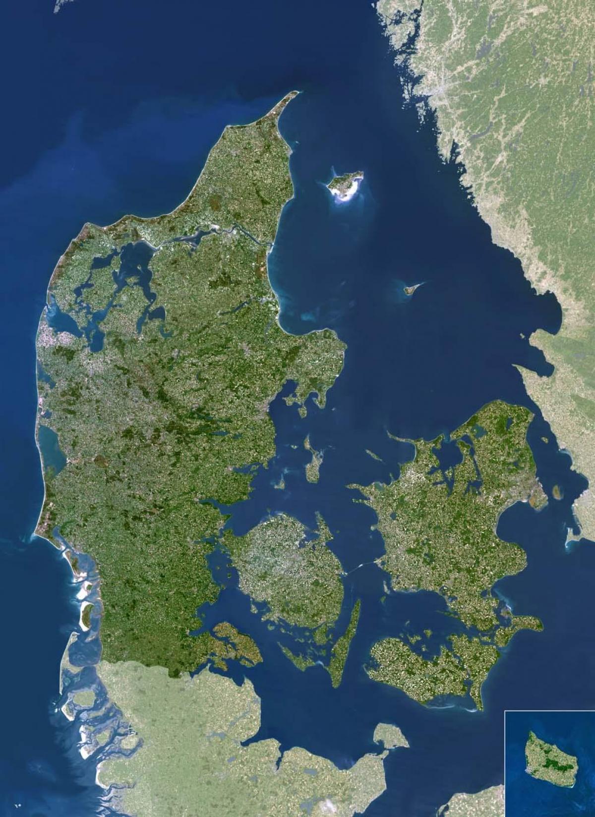
Denmark Locations as you can see in Denmark satellite map: Albaek Bugt, Arhus Bugt, Baltic Sea, Ho Bugt, Jammerbugten, Kattegat, Kieler Bucht, Kummel Bank, Laeso Rende, Lille Baelt, Limfjorden, Mariager Fjord, Mecklenburger Bucht, Nissum Bredning, Nissum Fjord, North Sea, Randers Fjord, Ringkobing Fjord, Saltbaek Vig Lake, Skagerrak, Stadil Fjord, Store Baelt, Tannis Bugt, Thyboron Kanal, Tisso Lake, Vejl Fjord and Vigso Bugt. A natural hazard for Denmark is flooding in some areas of the country that are protected from the sea by a system of dikes. For example, flooding occurs along the southern coast of the island of Lolland, and parts of Jutland.
Satellite view is showing Denmark, a country in northwestern Europe between the North and the Baltic seas. The Kingdom is located on the Jutland peninsula and several islands, north of Germany. Denmark comprises of the state of Denmark, plus the Faroe Islands and Greenland, both self-governing countries under the sovereignty of the Kingdom of Denmark. The national capital is Copenhagen (København). Official language is Danish. Denmark only land border is with Germany, it shares maritime borders with Norway, Poland, Sweden, and the United Kingdom as its shown in Denmark satellite map.
The two main islands of Denmark are Jutland and Zealand as its mentioned in Denmark satellite map. First, the Jutland Peninsula is the mainland region of Denmark stretching northward to Scandinavia. Whereas Zealand is the smaller of the two main islands but holds the capital city of Copenhagen. The rest of Denmark is the Danish Archipelago, which consists of a group of more than 400 islands. Seventy of the islands are inhabited, with the remainder completely empty of human settlements.